
PMRDA Launches GIS Portal: Pune Ring Road, Metro, Flood Lines and Planning Maps Now Just a Click Away
Reported by Mubarak Ansari
Pune, 6th August 2026: The Pune Metropolitan Region Development Authority (PMRDA) has launched a Geographic Information System (GIS)-based public portal to provide citizens, investors, developers, architects, engineers and government departments with easy access to planning-related information in a transparent and digital format.
Metropolitan Commissioner Dr. Abhijit Chaudhari said the GIS-based public portal marks a significant step towards making planning and development in the PMRDA region more transparent, efficient and citizen-centric.
“Citizens can now access official preliminary information related to roads, flood lines, Metro routes and regional planning around their land parcels with a single click from their homes. This will save time and reduce visits to PMRDA offices. PMRDA remains committed to promoting digital governance and delivering transparent and accessible public services,” he said.
The new platform enables users to access key regional planning data from their homes, significantly reducing the need to visit PMRDA offices for preliminary information related to land and development.
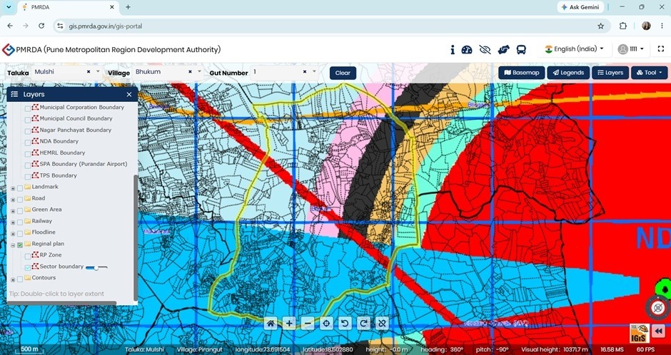
The GIS portal includes details of PMRDA’s jurisdiction, the approved Regional Plan (RP), proposed Town Planning (TP) schemes, village boundaries, and the limits of municipal corporations and municipal councils within the metropolitan region.
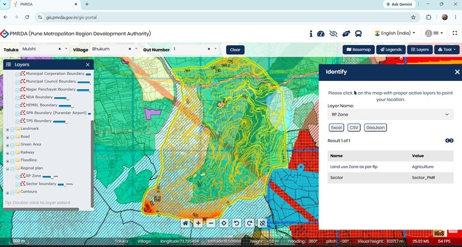
The portal also provides information on major infrastructure projects, including the MSRDC and PMRDA Ring Roads, Pune Metro corridors, railway routes, Public Works Department-classified roads and Transit-Oriented Development (TOD) zones surrounding Metro stations.
In addition, the platform is being expanded in phases to include environmental and safety-related information such as flood red and blue lines identified by the Irrigation Department, wildlife sanctuary boundaries, hill station and township limits, as well as buffer zones around defence establishments including the National Defence Academy (NDA), the High Energy Materials Research Laboratory (HEMRL), and the proposed Purandar Airport under the Maharashtra Airport Development Company (MADC).
According to PMRDA, the portal will allow citizens to obtain official preliminary planning information about their land parcels or surrounding areas without making repeated visits to its offices. The authority said this would save time, reduce costs and minimise administrative follow-ups.
The digital platform is also expected to benefit developers, architects and engineers by providing easy access to official planning data required while preparing development proposals. PMRDA said the initiative would improve transparency in the planning process, strengthen coordination among various government departments and promote data-driven decision-making for sustainable urban development.