Mahabaleshwar Gets “Weather Eye in the Sky” as IITM Commissions Doppler Radar
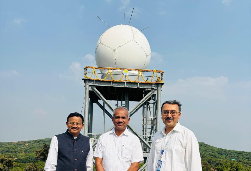
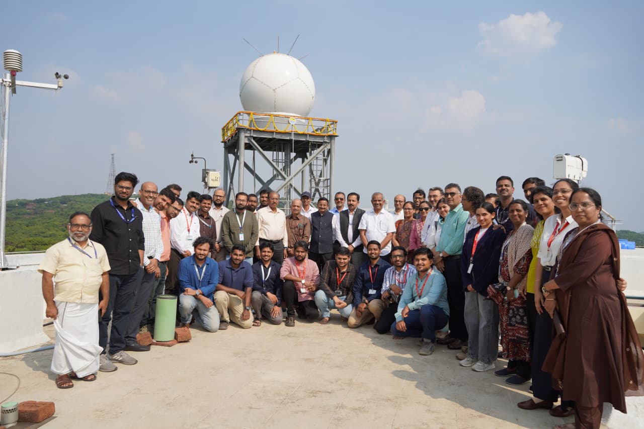
Mahabaleshwar/Pune, 28th April 2026: In a major boost to weather forecasting and climate research in India, the Indian Institute of Tropical Meteorology (IITM), Pune, under the Ministry of Earth Sciences (MoES), has commissioned a state-of-the-art X-band dual-polarization Doppler Weather Radar at the High Altitude Cloud Physics Laboratory (HACPL) in Mahabaleshwar under Mission Mausam.
The radar system was inaugurated on April 24, 2026, by Dr. M. Ravichandran, Secretary, MoES, in the presence of IITM Director Dr. A. Suryachandra Rao, Space Applications Centre (SAC), ISRO Director Somya S. Sarkar, and senior scientists.
Installed at an altitude of around 1,400 metres above mean sea level in the Western Ghats, the radar is expected to function as a “weather eye in the sky,” continuously scanning atmospheric conditions to track rainfall, clouds, and storm systems in real time. It will also help monitor rapidly changing weather in Mahabaleshwar, a popular tourist destination known for sudden rain, fog, and strong winds.
Officials said the radar will significantly enhance nowcasting capabilities—short-term weather forecasting up to three hours—for regions including Satara, Pune, and parts of the Konkan and Mumbai. It is designed to detect thunderstorms, intense precipitation, and cloud evolution, while also supporting early warning systems for floods and landslides.
Operating at 9.45 GHz using solid-state power amplifier (SSPA) technology, the system offers high reliability, energy-efficient performance, and low maintenance. Its dual-polarization feature enables detailed study of cloud microphysics, including precipitation particles, drop size distribution, and storm structure. With a spatial resolution of 75 metres, update cycles of 6–10 minutes, and a coverage range of up to 170 km, the radar is expected to improve quantitative precipitation estimation, especially in complex terrain like the Western Ghats.
Scientists noted that the radar will aid in studying orographic rainfall, monsoon dynamics, deep convective processes, and extreme weather events. It will also support applications in aviation safety, agriculture advisories, disaster management, and water resource planning.
On the same occasion, IITM signed a Memorandum of Understanding (MoU) with the Space Applications Centre (SAC) of the Indian Space Research Organisation (ISRO) to co-develop advanced satellite-based meteorological products.
The collaboration will focus on integrating satellite and ground-based observations to improve cloud analysis, air pollution monitoring, and atmospheric profiling. It also aims to enhance prediction accuracy through advanced data retrieval techniques and validation of satellite products.
According to officials, the MoU will strengthen research in key areas such as atmosphere–ocean–land interactions, aerosol-cloud-precipitation processes, deep convection, lightning, and climate change impacts. It will also promote real-time data sharing, field campaigns, and the development of emerging technologies, along with capacity building through training and workshops.
Addressing the gathering, Dr. Ravichandran said the radar marks a significant advancement in strengthening early warning systems in ecologically sensitive and high-tourism regions like Mahabaleshwar. He noted that real-time detection of convective systems and sudden weather changes would improve alerts for heavy rainfall, fog, and strong winds, enhancing safety for both residents and tourists.
Dr. Rao said the radar would provide high-resolution data critical for understanding storm development and improving weather and climate models. He added that insights from the system, combined with other observational tools at HACPL, would enhance prediction accuracy for extreme weather events.
Sarkar highlighted that the collaboration between IITM and SAC would integrate satellite remote sensing with ground-based observations, strengthening India’s overall weather and climate monitoring capabilities.
The initiative is seen as a key step in advancing India’s weather science ecosystem, improving early warning systems, and building resilience against extreme weather events.