A New Development Plan for Pune’s 23 Merged Villages: A Once-in-a-Generation Opportunity
Pune, 1st July 2026: The Maharashtra Government’s notification of 11 February 2026, restoring planning authority for the 23 merged villages to the Pune Municipal Corporation (PMC), followed by the PMC General Body’s approval on 23 June 2026 to prepare a fresh Development Plan (DP), marks a defining moment in Pune’s urban expansion. With City Engineer Aniruddha Pawaskar appointed as the Town Planning Officer, the city now has an opportunity to reshape its rapidly growing suburbs through scientific, sustainable and people-centric planning.
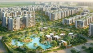
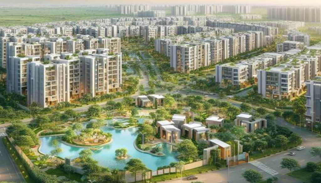
The villages merged into PMC in 2021 have witnessed unprecedented residential growth over the past decade. High-rise townships, gated communities and commercial developments have transformed the skyline, yet public infrastructure has struggled to keep pace. Residents continue to grapple with narrow roads, inadequate public transport, unreliable water supply, insufficient drainage, disappearing open spaces and a lack of schools, healthcare facilities and recreational areas.
The absence of a dedicated Development Plan has meant that building permissions were largely governed by the Regional Plan, which lacks the micro-level zoning required for dense urban settlements. The new DP provides an opportunity to correct this imbalance and create neighbourhoods that are not only economically vibrant but also environmentally resilient and socially inclusive.
Protect Pune’s Blue-Green Infrastructure
The merged villages possess a valuable network of natural streams, seasonal nallahs, ponds, wetlands and hill runoff channels. In the Pisoli region, natural drainage systems flowing through Wadachi Wadi, Autade-Handewadi, adjoining hill slopes and neighbouring villages ultimately contribute to the wider watershed. Similar ecological networks exist across Undri, Sus, Mhalunge, Bavdhan, Nanded, Kirkatwadi, Wagholi and other merged villages.
Before finalising land use, PMC should undertake comprehensive GIS mapping of every natural watercourse, wetland and floodplain. These features should be recognised as critical civic infrastructure rather than vacant land available for future construction.
Where natural nallahs possess adequate width, they should be developed as Nallah Parks—continuous green corridors incorporating walking and cycling tracks, native tree plantations, rain gardens, wetlands, biodiversity pockets and children’s play areas while preserving the natural flow of water. Such projects would simultaneously improve flood management, groundwater recharge, urban biodiversity and public recreation.
Respect Natural Drainage and Flood Lines
Climate change has increased the frequency of intense rainfall events, making scientific flood management essential.
The officially demarcated Blue and Red Flood Lines must be clearly incorporated into the Development Plan. Development proposals should strictly respect these boundaries, while natural drainage channels should remain free from encroachment and unnecessary concretisation. Preserving the natural hydrology of these villages will significantly reduce urban flooding and safeguard lives and property.
Adopt Micro-Level Planning for Public Amenities
The next generation of urban planning cannot rely solely on broad regional zoning. Every neighbourhood requires accessible civic infrastructure within walking distance.
The Development Plan should reserve adequate land for government schools, healthcare centres, fire stations, police facilities, public gardens, playgrounds, libraries, community halls, sports complexes and cultural spaces. As populations continue to grow, such reservations will prevent future shortages and reduce pressure on already congested parts of Pune.
Build Connected Road Networks Before Development Intensifies
Many internal roads across the merged villages continue to follow historic village alignments despite serving thousands of residents today.
The Development Plan should establish interconnected road grids with appropriate right-of-way ranging from 18 to 45 metres wherever technically feasible. Every major road should include dedicated underground utility corridors accommodating water pipelines, sewerage, storm-water drains, electricity, gas and communication networks. Planning these services together will eliminate the recurring cycle of road excavation after construction.
Safe footpaths, cycling infrastructure, universal accessibility and efficient public transport integration should become mandatory components of future road planning.
Ensure Water Security Before Approving New Construction
Dependence on private water tankers has become one of the defining challenges of South Pune’s rapidly expanding suburbs.
Future residential growth must be supported by scientifically planned reservoirs, elevated storage tanks, water treatment facilities, sewage treatment plants and integrated storm-water management systems. New large-scale developments should be synchronised with verified long-term water availability and supporting civic infrastructure rather than relying on temporary tanker-based solutions.
Preserve Open Spaces and Urban Biodiversity
Rapid urbanisation must not come at the cost of ecological balance.
Natural hills, biodiversity patches, old tree clusters and public open spaces should be integrated into the Development Plan as permanent green assets. Native tree plantations, urban forests and ecological corridors connecting hills to water bodies can improve air quality, reduce urban heat and strengthen climate resilience while enhancing the quality of life for residents.
Citizens Must Participate in Shaping the Future
The preparation of the Development Plan will involve surveys, public consultations and statutory opportunities for citizens to submit suggestions and objections.
Residents, housing societies, environmental groups, urban planners, architects and local institutions should actively participate in this process. Local knowledge regarding recurring flooding, traffic bottlenecks, water scarcity, biodiversity and community needs can significantly improve the final Development Plan.
Planning for the Next Fifty Years
PMC estimates that preparing and implementing the Development Plan will take several years. However, the decisions made during this exercise will shape the future of Pune’s expanding suburbs for decades.
This is not merely an exercise in allocating land for roads and buildings. It is an opportunity to create neighbourhoods where infrastructure grows alongside population, where natural streams remain living ecosystems instead of concrete drains, where parks and public amenities are available within every community, and where sustainable development becomes the foundation of urban growth.
The people living in Pune’s merged villages contribute to the city’s economy, pay municipal taxes and deserve the same quality of civic infrastructure enjoyed elsewhere in the city. If planned with vision and scientific rigour, the new Development Plan can transform these 23 villages into model urban communities that balance growth with environmental conservation, resilience and liveability.
The choices made today will determine whether Pune’s future suburbs become congested concrete landscapes or well-planned neighbourhoods that future generations will be proud to call home.