Pune HCMTR Project: 36-Km Elevated Corridor May Cut Travel Time, Ease Traffic on Major Roads
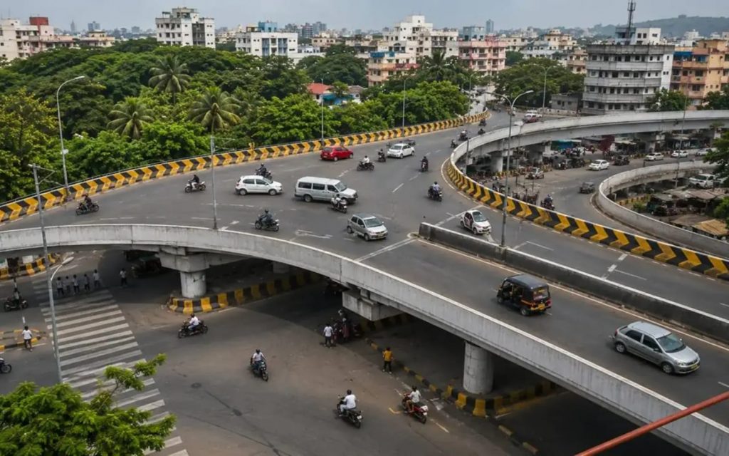
Pune, 8th August 2026: The proposed High Capacity Mass Transit Route (HCMTR), a 36-km elevated circular corridor planned across Pune, is expected to provide an alternative route for commuters and reduce traffic pressure on the city’s central roads. The ambitious project could directly benefit lakhs of residents across southern, eastern, western and northern parts of Pune, while improving connectivity with public transport.
The HCMTR is planned to connect several major radial roads without requiring commuters travelling between different suburbs to pass through central Pune. According to the project details, around 10–13 lakh people living within one kilometre of the corridor could have direct access, while the broader service area could potentially benefit 30–40 lakh people through feeder bus services.
36-km elevated circular corridor
The proposed elevated corridor will be approximately 35.96 to 36.04 km long and 24 metres wide. It is planned with six lanes, 34 major junctions, 17 up-ramps and 16 down-ramps, making a total of 33 ramps.
The proposed speed on the main corridor is 50 kmph, while vehicles on ramps are expected to travel at around 25 kmph.
The project will require approximately 115.68 hectares of land, with the land acquisition cost estimated at around ₹3,000 crore in the presentation.
An earlier technical proposal had envisaged two dedicated lanes for Bus Rapid Transit (BRT) and four lanes for other vehicles, along with 26 elevated bus stations. However, a recent administrative presentation describes the corridor more broadly as having six lanes for public transport and private four-wheelers. The final configuration will need to be clarified through the revised DPR or tender process.
Connectivity across Pune
The proposed route will pass through several important areas, including Bopodi, Khadki, Pune University, Senapati Bapat Road, Paud Phata, Karve Road, Dandekar Bridge, Swargate-side areas, Gultekdi, Gangadham, Lullanagar, Vaiduwadi, B.G. Shirke Road, Vadgaon Sheri, Ramwadi, Viman Nagar, the airport area and Vishrantwadi.
The corridor is expected to provide an alternative route between areas such as Kothrud and Viman Nagar, or the University area and Swargate, without requiring commuters to travel through the congested central parts of the city.
HCMTR could save up to an hour on some journeys
With a proposed speed of 50 kmph, a 36-km journey on the elevated corridor could theoretically be completed in around 50–60 minutes by private vehicle under smooth traffic conditions. An express bus with limited stops could take around 60–70 minutes, while a bus stopping at all stations could take approximately 75–90 minutes.
During peak hours, travelling across the city through existing surface roads can take significantly longer. With effective implementation and traffic management, the HCMTR could potentially save 25–60 minutes on some journeys.
Dedicated bus lanes seen as crucial
Transport planning experts and the project proposal emphasise the importance of giving public transport dedicated priority. If all six lanes operate as mixed traffic, buses could also get caught in congestion, reducing the project’s public transport benefits.
A proposed model could include clockwise and anti-clockwise circular bus services, with buses operating every three to five minutes during peak hours and every seven to 10 minutes during non-peak periods.
Feeder electric buses could also connect HCMTR stations with surrounding areas within a radius of around three to seven kilometres. Proposed feeder connections include University–Baner-Pashan, Paud Phata–Bavdhan-Warje, Swargate–Sinhagad Road-Katraj, Gangadham–Kondhwa-Undri, Hadapsar–Fursungi and Ramwadi–Kharadi-Wagholi.
Project yet to enter construction stage
The HCMTR concept was originally included in Pune’s 1987 Development Plan. In 2024, the state government approved certain changes to the proposed route while directing that necessary environmental clearances be obtained before implementation.
In June 2026, steps were initiated towards establishing a Special Purpose Vehicle (SPV) to accelerate the HCMTR, Ring Road and proposed tunnel projects. At an Executive Committee meeting held on July 18, 2026, concerned departments were directed to submit land acquisition proposals within specified deadlines.
The project is currently in the pre-implementation, land acquisition and pre-tender preparation stage, and construction work has not yet started.
HCMTR alone may not eliminate congestion
While the elevated corridor could divert long-distance traffic away from roads such as Ganeshkhind Road, Senapati Bapat Road, Karve Road, Paud Road, Sinhagad Road, Satara Road, Solapur Road, Nagar Road, Airport Road and the Vishrantwadi-Yerawada route, experts caution that congestion could shift to the ends of the ramps.
Junctions such as Paud Phata, Karve Road, Swargate, Gangadham, Lullanagar, Hadapsar, Ramwadi, Viman Nagar, Vishrantwadi and University Chowk could face additional pressure if adequate signals, turning lanes, bus bays and vehicle storage capacity are not planned.
There is also a risk of induced traffic demand, where improved road capacity encourages greater private vehicle use over time. Therefore, dedicated public transport infrastructure, feeder buses and integration with Metro and railway services will be crucial if the HCMTR is to deliver its intended long-term benefits.